Xaadée ‘Wáadluwaan Née • XaaydaGa ‘Waadluxan Naay
Council of the Haida Nation
To steward the lands and waters of the Haida Territories on behalf of the Haida Nation, and to perpetuate Haida culture and language for future generations.

-
Iid kuuniisii asii id gii isda gan. Tllgaay ad siigaay Gan t’alang aaxana ad yahguudang. Huu tllguu Giidan hlk’inxa gaa.ngang xaayda hllng.aay gud giijaagids, gaay Gaaganuu gam gina daaGang.nga id gwii is hllnga Gang ga. XaaydaGa Gwaay.yaay Gaaganuu iid xaynanga ga. Asii gwaay.yaay guu, iid kuuniisii xaynang.nga, ad siing.gwaa’ad gan. Sah ‘Laana Tllgaay Gaa id gii kyaagang.ngaay Gaaw aan t’ang naaxang sGwaan.nang Gas ga. Iid sihlGa ga xaynangas gii t’alang t’aas.slas, asii kyang.gaay llgaay ‘waagii kilxii gang ga
-
Iitl’ kuníisii áajii gwaayee iitl’ ga t’asdlagan. Áajii gwáayee inggu gin ’waadluwaan t’aláng ísdaas G̲an t’aláng yahgudáng-gaa, gin ’waadluuwaan t’aláng ísdaas uu áajii tlagee, isgyaan siis, isgyaan sangee sda isgáagang. Áajii gwáayee k̲iid k̲’úlaas gingaan iitl’ x̲aadaas asán G̲íidang, ahljii ahluu tliisdluu iitl’ ga ’wáajaagahls dluu, itl’ gwii asán k̲áahlasang. Áajii gwáayee uu iitl’ ga x̲íinang-gee ísdagan. Iitl’ kuníisii gin G̲aatláandagiinii gingaan uu wéed x̲aadee gin G̲aatláahlaal hlangaas gin G̲an unsadasaang. Áajii gwaayee ingguu iitl’ kuníisii x̲íinangaagiinii, wéed áadlan ’lhlG̲íwaawaang. Áajii gwaayee inggu iitl’ asán x̲íinangaas k’yaahl gu tlíisdluwaan iitl’ asan áadlan hlG̲íwaa’asaang.
-
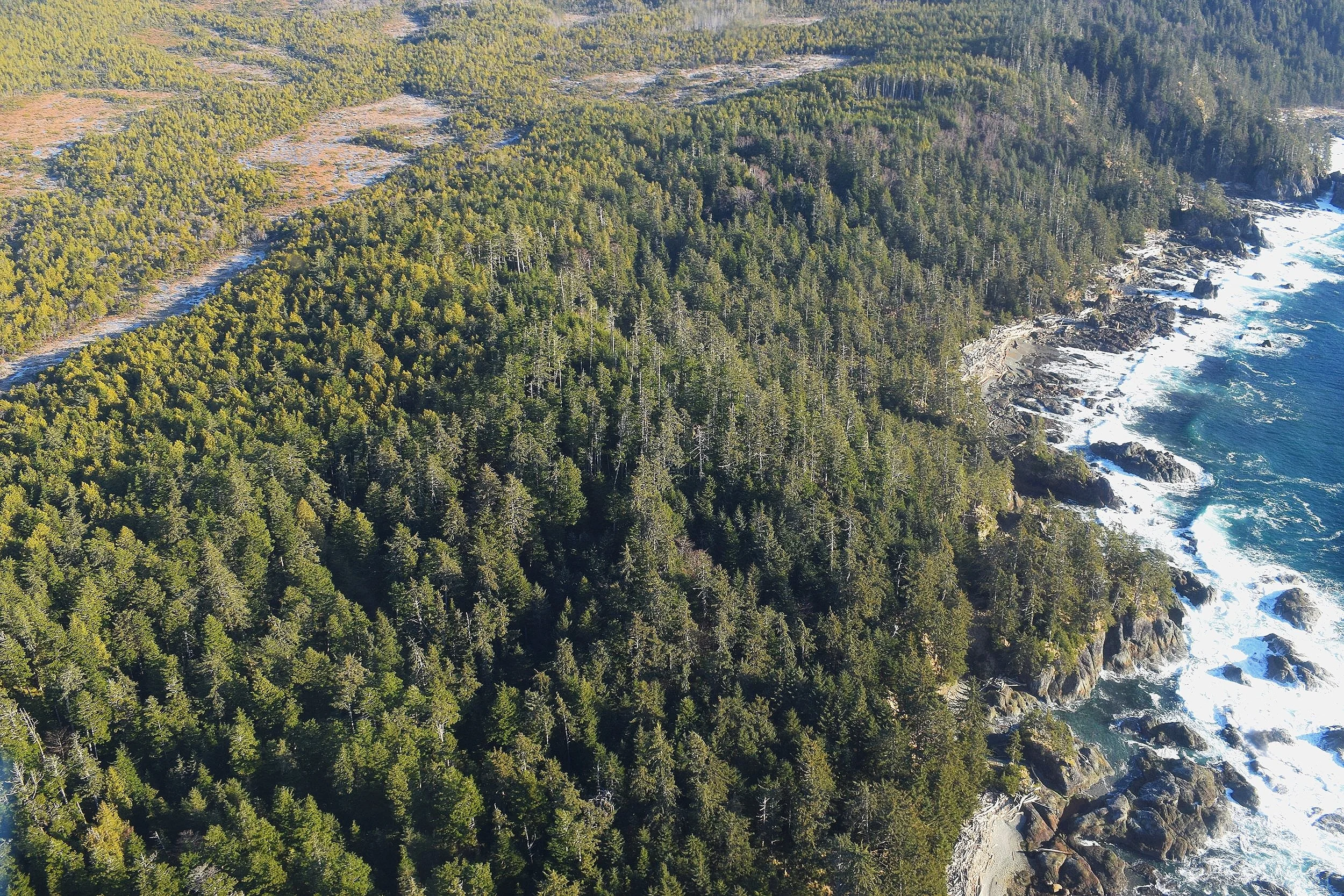
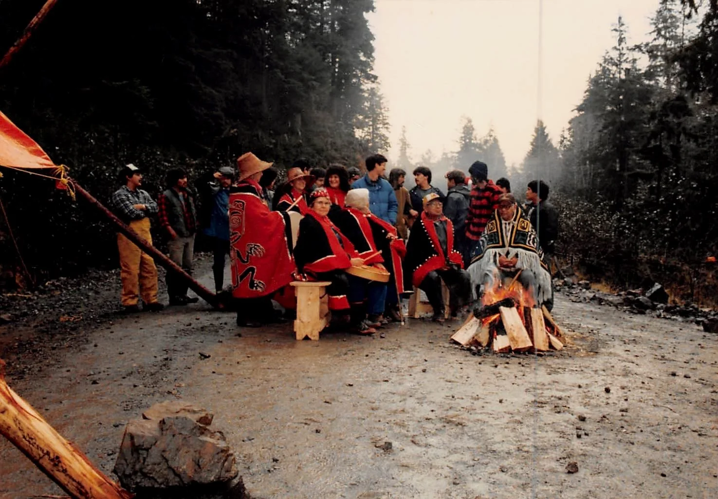
The Haida Nation is the rightful heir to Haida Gwaii. Our culture is born of respect; and intimacy with the land and sea and the air around us. Like the forests, the roots of our people are intertwined such that the greatest troubles cannot overcome us. We owe our existence to Haida Gwaii. The living generation accepts the responsibility to ensure that our heritage is passed on to following generations. On these islands our ancestors lived and died and here too, we will make our homes until called away to join them in the great beyond.
Public Notices
Stay up to date on news from the Haida Nation!
Learn More About What We Do
Governance
+ Policy
Marine
Stewardship

Land
Stewardship
Communications
+ Language
Upcoming Events
Find all the events happening on Haida Gwaii and CHN hosted events off-island!
If you would like to add an event to the website, let us know in the form on the Events page!